The Travelin' Croakers

Sunday, October 27, 2013

Brasstown Bald & Off-Roading (Sort of)

A few years ago when we were in Hiawassee visiting my parents, Mom took me and the boys on a little driving adventure. We rode in my Dad's Geo Tracker (Butterbean) with the roof off, and went down a dirt road I didn't know the name of, but my Dad called the area "Corbin Creek" from his childhood.
Now apparently known as "Swallow's Creek WMA".

We rode through a creek, and up and around and down dirt and rocky roads.
When we emerged on the highway again, we were down near Helen, Georgia, and stopped at a roadside stand for a cup of hot boiled peanuts.    

The memory of that little impromptu adventure has stuck with Ryan all this time, and when I told him about going to ride the Blue Ridge train and going on to Hiawassee, he mentioned that he'd like to take his SUV on that road that Nanny had taken us on, and maybe going to visit in Helen since it's been quite a few years since we've visited there, too.  

Since we were going right by there, I wanted to go up Brasstown Bald mountain and see the Fall Foliage from up top.

(It's been awhile since we've been up Brasstown Bald, too. Last time we went we didn't have to pay anything to get in. Now it's $5.00 per person.)            


Unfortunately, the weather wasn't so great this morning and there were a lot of clouds and wind up top.      


We spent some time hanging around in the museum, waiting to see if the clouds were going to blow on over, but eventually we gave it up and headed on back out.

We did walk the .6 mile trail back down, rather than taking the shuttle we'd take up. It was a nice, leisurely walk. The wind wasn't blowing so crazy and it wasn't as cold as up top.

Here we are crossing Corbin Creek on Indian Grave Gap Road.


There was a Waterfall off this road about a half - or a mile hike Ryan had found out about online. I was scared to do much hiking out in the woods on account of it being hunting season, but once we got to the place to get to the Falls, there were already like 8 vehicles parked there and no where for us to park anyway.

We rode, and stopped off at a few pull-off/campsite areas, checking out the scenery and taking "Off-roading" pictures and other interesting things. You know, like a Red Couch in the forest.


We went on up the mountain and turned onto Tray Mountain Road, which is apparently a bit less used than Indian Grave Gap Road. It was practically washed away and was more rock (and sometimes boulders) than dirt road.


 We came across a few minor waterfalls. These were some pretty awesome ones, but I could really only photograph the top few levels of it because the rest of it dropped way down, with no way of getting down there (safely). I had already slipped and fell on my can climbing down to get to these.


Three or so hours later, we finally found our way out, in a different place than Mom had taken us, but still near the City of Helen.

Helen is one of the most unique towns I know of, the entire town is a Tourist attraction, a re-creation of an Alpine Village. It's been like this since for as long as I can remember, when Granny and Papa used to take me there as a kid, and we used to take our kids when they were little.

Before it got so renowned and popular. Now you can't hardly get in the place in the Summer, and for-get Oktoberfest, it ain't happening.

We made our way on through town, and maybe will go back and check out the Christmas decorations next month.


Outside of town we stopped at Nora Mill, a still-working grist mill since 1876.


Water from the Chattahoochee River turns the stone-grinder, making meal, flour, grits, etc.


They've changed things somewhat since we were here last...which I had no idea was as long ago as it was.
This deck/overlook wasn't there then, and you could stand on the bank of the River, even get in and wade around.
I have a picture of Ryan at 2-years-old standing in front/beside of these same falls, about 21 years ago.


Then we went home. I love little weekend adventures.

Saturday, October 26, 2013

Blue Ridge Fall Foliage

 This weekend we went up to Blue Ridge, Georgia  to ride the Blue Ridge Scenic Railway's Fall Foliage train.


The weather was pretty much perfect Fall weather: clear, blue sky, bright and sunny, a bit of a chill in the air but not too cold. Just plain gorgeous.


The train ride was nice. There were pretty and interesting sites to see in the back country, and we bought Apple Cider Slushies and fried apple pies from the concession car. We'd never had Apple Cider Slushie before, it was yummy.


The train ride was about an hour trip up to the twin cities of McCaysville, Georgia, and Copper Hill, Tennessee.  The State Line literally runs right through the town, through the IGA grocery store, and a restaurant, and other buildings/businesses/etc.


It was pretty funny that it happens to be Polk County, Tennessee right there. Polk is the county we live in Georgia, and my sister lives in in Florida, haaaaa. What are the chances?
Ryan was wearing a Polk County Fire Dept. cap and a lady on the train thought it was Tennessee, and he was thinking Georgia, of course, so it was a funny conversation for a minute there.


We spent about an hour and a half in McCaysville/Copper Hill, walking around town, checking out the sites, looking around in some of the stores.

Everyone got a kick out of the McCaysville Drug & Gun shop.


We bought some fudge, chocolate covered pretzels, got my Smashed Penny souvenir, and ate at Georgia Boy BBQ (which, sorry, I wouldn't recommend).

After arriving back in Blue Ridge, we headed for Hiawassee, Georgia, to spend the night at my/parents house.

Monday, June 24, 2013

Florida Family Visit

Friday before last, my Sister texted me and said I needed to come down (they live in central Florida) and visit them. Realizing my calendar is going to be pretty well filled for the next month or so, I decided I'd better go for a quick visit while I could.

 J & Ryan couldn't get off work at such short notice, so me, Kevin and my Aunt Rita headed out.

First we went to my parents place in Steinhatchee, Florida.

They bought this house and have been working on remodeling for about a year.
The bottom used to be open and the porch used to be square (left side of the pic). Dad angled the corners and made it look like a boat, or an ark, lol.


On the water-end he built on a Double-Decker-Party-Deck. It's pretty awesome.


My Sister and her family had visited the 'rents the day before we got there. They had brought Mom lots of tomatoes and peppers from their garden, so me and Ma made some homemade Salsa.

I'd share the recipe, but we just found a basic one off the internet, then Mom customized it with what she had or wanted to add. She's one of those peeps that can just put stuff together and it taste good.


The Tasters


We had a nice couple days visit with Mom and Dad, then headed out to my Sister's house in Lakeland, Florida. 

Being Florida, I guess I don't have to tell you it was *h*o*t*.  We had a big time putting her awesome pool to good use.


My loverly neices


We had a really nice visit with my Sister and Brother-in-law and my two nieces and two nephews.
We went out for lunch one day, and went to Ikea in Tampa the next day. Ikea is awesome!

Sunday, June 9, 2013

Cloudland Canyon State Park

This weekend we made a "One Tank Trip" and spent the day at Cloudland Canyon State Park in extreme Northwest Georgia, about a 2-hour drive from home.


We had visited Cloudland Canyon previously a few years ago, but it was in the off-season, maybe December if I remember correctly. We had been out shopping, or something, and ended up just riding up there because we were nearby. But everything was closed up and we didn't have any maps or information, I hadn't looked up the website at home (didn't have Mobile Internet back then). So we said we'd go back later, in the Spring or Summer.
Didn't exactly mean several years later, but that's the way it goes sometimes.

Recently I saw on the Georgia State Parks Facebook page that they were offering an Overlook Hike on Saturday mornings during June, and decided that would be a great time for us to go.

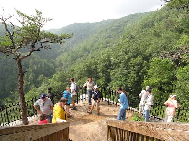
We met at the Interpretive Center around 10am, and with our friendly guide, Stephanie, headed out on our hike around part of the Overlook and through some forest.


The main point of this hike was more of an informative walk, which was actually exactly what I was looking for.  We're not real huge on group activities, following someone else's time clock, being able to stop and take pictures, drink water, change lenses, rest our old, tired butts...
But I have learned from past experience that getting in on a group thing or at least with a knowledgeable leader, you can find out things you might not know or might otherwise miss out on.

That would certainly have been true in our case. We probably never would have went down the little unmarked, unpaved trail that led to this and another viewing platform had Stephanie not taken us there.


We learned the name of this divide - Sitton's Gulch - and that Bear Creek and Daniel Creek converge to form Sitton's Gulch Creek. We were shown where the different trails start and where they would take us, told about how long and/or strenuous the hikes would be. So that was awesome and I'm really glad we got in on it.


After our guided hike, we set out on the Waterfalls hike on our own.

Daniel Creek drops from the rim of the trail to the floor in a series of cascades and waterfalls, two of which are named - Falls #1: Cherokee Falls and Falls #2: Hemlock Falls.

Cherokee Falls was our favorite.


Hemlock Falls was a bit thin-ish, and honestly I guess we just like being able to get closer to the Falls.


On our way back from the Waterfalls hike, we went a short distance on the Sitton's Gulch Trail, but not very far because we were hungry and getting tired.

It's hard to tell from the picture, but we were pretty far down into the canyon at this point. In about the center of the picture you can see the rocky ledge of the canyon rim way, way above us.


Going up.


Canyon view some way back up.


Still going up.


After we hiked back up out of the canyon, we sat down for a rest and enjoyed our picnic lunch in the shade.


After lunch and rest, we went back to the Interpretive Center and checked out the native animals and other informative stuff.


Then we did part of the Overlook Hike again on our own, so we could take our time and take pictures. The Canyon looks different in the afternoon/evening than it does in the morning, with the angle of the sun and minus the morning fog/mist we had this morning.


Awesome views. Hard to believe this was once under the Ocean, and then later on the rim of the Canyon was a Beach. Amazing!